County Tipperary

It’s a long way to Tipperary… not really, just a 2 hour drive from Knockcroghery, but it’s the next stop on our investigation of the Irish Interior.

We have lots of time before our check-in time at the Calf Barn, so we stop at Clonmacnoise in County Offaly. The original monastery on this site, on the banks of the Shannon river, was founded in 544 by St. Ciaran (who was not a Saint at that time).

Between the 8th and 12th centuries this monastery was attacked an astounding 40 times. Seven times by Vikings. Six times by Normans. But most of the sacking was done by the Irish – 27 times.

In 544 Ciaran and 9 others built the original wood structures. Stone buildings replaced the original wood starting in the 9th century, and the population grew to about 2000 in the 11th century.

Clonmacnoise was abandoned in the 13th century and currently contains the ruins of 9 churches, a castle and 2 round towers.

Map of Clonmacnoise ruins
Left side shows largest remaining structure (a cathedral), with 2 smaller churches on the right side.

Many (most?) signs in Ireland have both English and Irish names. The English names are often phonetical spellings of the Irish. For example, the Irish name Cluain Mhic Nóis becomes the English name Clonmacnoise (clon – mac – noise, pronounced as expected).


Time to head to the Calf Barn in County Tipperary which is the cottage we have booked through Airbnb. Our favourite booking site is Sykes Cottages, but Sykes seems to focus on coastal properties, hence our use of Airbnb for interior stays.

The Calf Barn is located on a working farm in Lismakeeve, which is an Irish Townland that contains the hamlet of Ileigh where we are staying. The Airbnb description of the place is “a former cattle house previously used for housing calves, and recently converted to a cosy 2 bed farmhouse”. We had previously had a very nice stay in a converted sheep and pig barn, so this sounded like more fun.

After being in the barn for a couple of days I met the farmer. He told me that the Airbnb was run by his son and that there had never been a single cow in the barn, ever. It used to be a residence for farm workers. I guess the son thought that marketing the property as a converted cow barn was more interesting. It didn’t matter to us as it was a very nice cozy place to stay!

The Calf Barn in front, with the real cow barn at the back (with the rounded roof)
The only heat comes from a wood stove, plenty cozy when it's going, but a wee bit chilly in the morning

Most of the places we have staying while in Ireland have a clothes washing machine, usually located in the kitchen, but no dryer. For those places that don’t have a drying rack (or only have a small one) laundry day requires a bit of creativity.

It rains, a lot, in Ireland and most places we have stayed don’t have anywhere to put wet coats. Also, there is no central heating (individual room heaters – electric or hot water) and houses can be cool with higher ambient humidity, so we don’t know how the Irish get anything to dry out. Still a mystery. 

The nearby Devil’s Bit Loop sounded like a nice place to take the dogs for a walk. Billed as a moderate 5 km trail and “A satisfying hill walk on Devil’s Bit Mountain, this pleasant loop takes 90 minutes to complete.”

Starting from the car park the trails goes up a steep slope for about .7 km where it comes to a 4 way intersection. The trail map indicates a branch path up to the peak (where a cross can be seen). I remember some comments about this branch path saying that it is a bit of a scramble, so probably best to avoid this with our large dogs. We take the left path and I am thinking that we will get back to this same intersection after a pleasant 5 km walk around the hill. 

There are ruins everywhere in Ireland. This old tower is located at the intersection of the trail paths
View from the trail. You can clearly see the managed forests (tree harvesting and replanting area). The clear area on the slope has been recently clear cut.

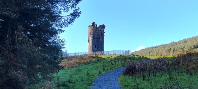
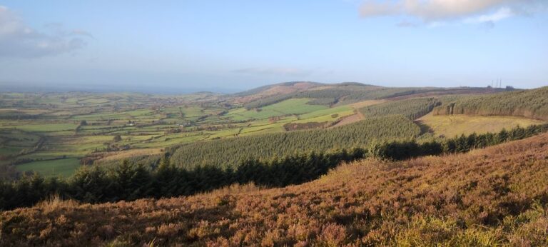
We missed a turn (trails are not well marked) and ended up at the radio towers that can be seen on the far left of the photo. We were supposed to be either back at the intersection where we started or somewhere near the peak that can be seen on the right of the photo (with the cross on the top).

When we got to the radio towers we had done 5 km. We stopped an looked back and could see the peak with the cross on it a few km away. Time to turn around and head back.

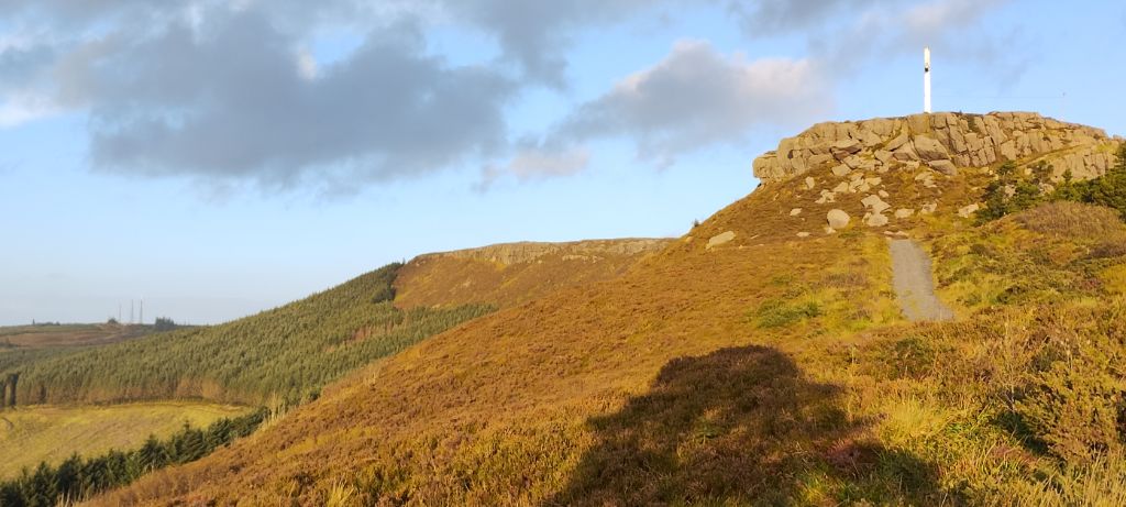
On the way back, after 2+ km we found a trail marker that could only be seen from one side (not the side we originally came from of course), so we headed up the new trail and it got us to the base of the peak (where photo was taken).

The nice wide trail we had been following turned into an unmaintained, narrow pathway that led to the base of the peak. The trail then turned into a real scramble as it headed up to the peak. Lump was a rockstar (pun intended) as he scrambled up boulders. When we came to a 3′ vertical climb, Lump and I stopped while SweetPea dragged her mom up the vertical rise. They went ahead to scout out the trail as I didn’t want to herd Lump up unless the trail improved.

A few minutes later the scouts came back to report… “trail gets worse”. Looking back down the side of the hill that we had climbed so far, we see what looks like a tiny trail heading around the peak instead of up the peak. We decided to head back down and try this trail. 

Lump, who is 135 lbs, is much better going down than up, so we quickly arrived at the trail we had seen from above. Not much of a trail. Narrow. Deep (sides were over the dogs’ heads). Muddy with roots and rocks. Not much choice at this time as it was around 4 pm and starting to get darker (sunset is around 5 pm), so the scouts go first with Lump and I bringing up the rear. We push our way ahead until we come to a point in the trail where it pass between two rocks that form a V shape. Immediately past these two rocks the path drops by a couple of feet. The scouts leap through the V with alacrity. I am not sure if Lump can make it. Lump sees our intrepid scouts disappearing around a bend and whines a little bit (he doesn’t like to be left behind), he then gives a mighty jump… and lands in the middle of the V. Wedged in place with his front paws dangling in the air. The most amazing thing is that Lump doesn’t yelp or even squeak. I don’t know if that is because he is wedged so tightly that he can’t breathe or if he is just a trooper (I prefer to think it is the latter).  I scramble into a position over top of Lump with one foot on each of the rocks making up the V, get a good grip on Lumps walking collar and then heave. As Lump gradually rises from the wedge he manages to scramble backwards by himself (it is all I can do to lift him at this point).

Finally back on solid ground, I think that this is it, we are going to have to turn around and walk about 3 km back to where we started, because Lump is not going to try that again. Not looking forward to hiking in the dark, so I try to convince Lump to scramble up one side of the V and then jump down to the path. Much to my surprise he acquiesces! In an astonishing (for Lump) display of agility he scrambles up one side of the V rock and leaps (ok, maybe more like a semi-controlled fall) down to the path on the far side. We are through!  Lump forges ahead and catches up with our scouting team, who have found a path that takes us to a set of 6×6 lumber steps embedded in the slope of the hill. We are finally back on a real trail. We head down this steep slope and finally come upon the intersection where this adventure began. Phew!

A short .7 km walk back down to the car park and we are done (in more ways than one). Our pleasant 5 km walk was more like a pleasant 8 km walk plus a strenuous 1 km scramble. No injuries, so all is good, and Lump gets the award for Rockstar of the day!


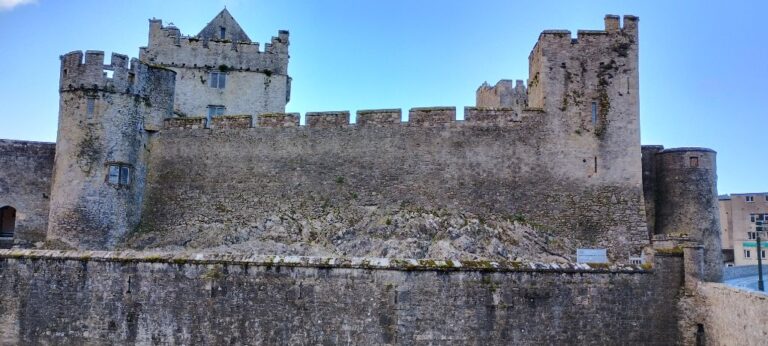
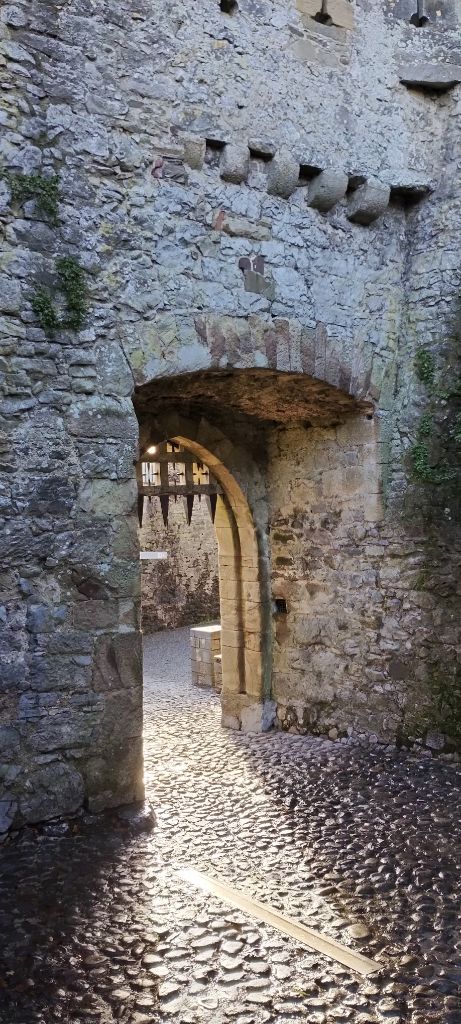
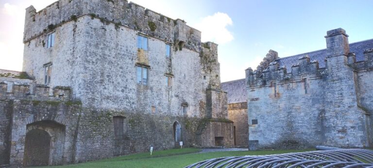
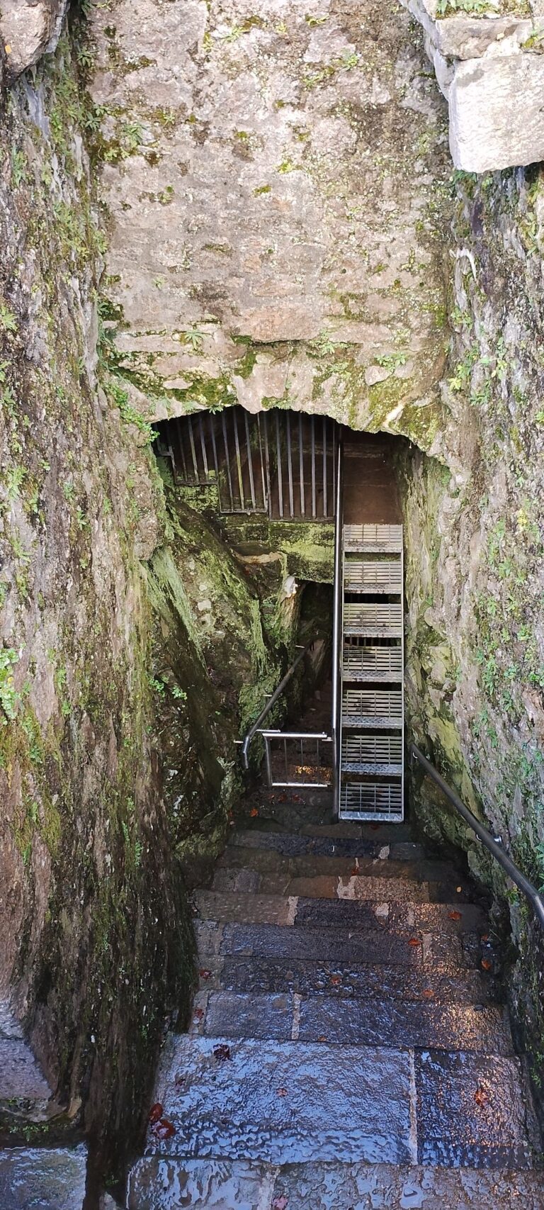
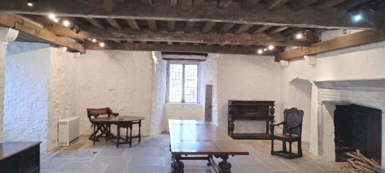
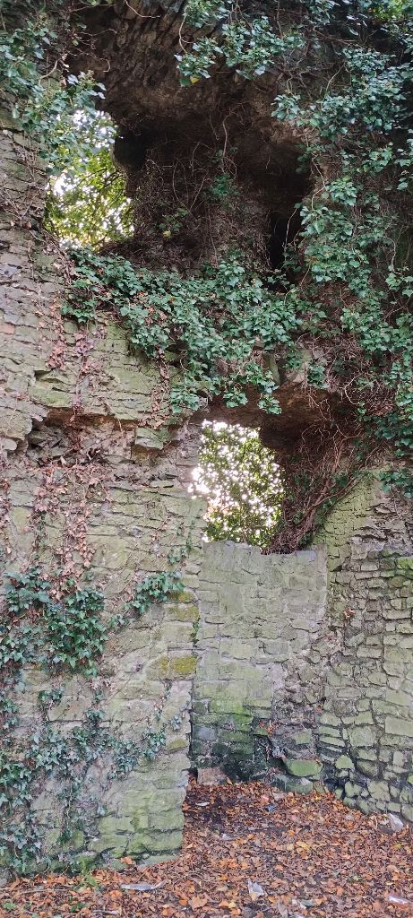
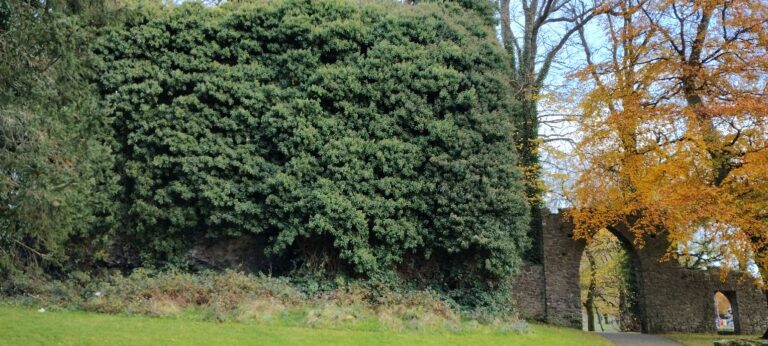
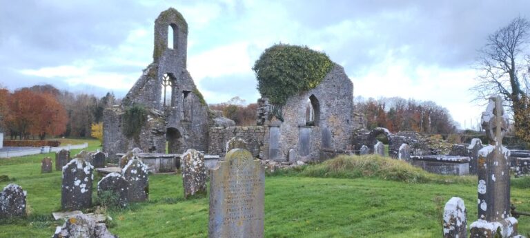
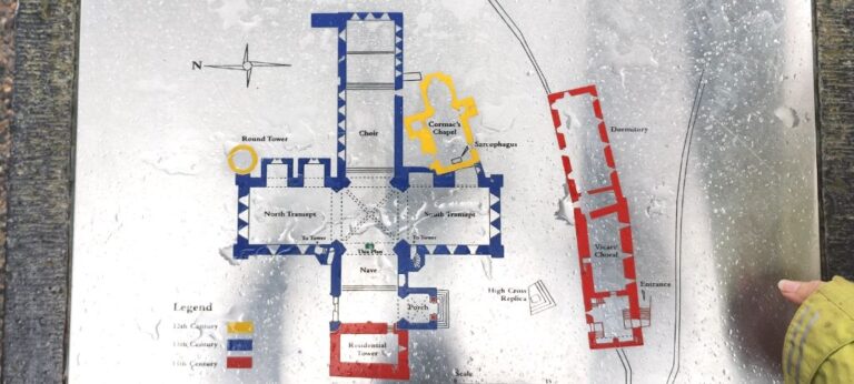
After taking a day to recuperate, we head out to visit Cahir Castle. Built in the 13th century it was believed to be impregnable, and remained so until 1599 when it fell to heavy artillery.

Cahir Castle is located on the river Suir in the centre of the town of Cahir (main road can just be seen on the right)
Cahir Castle is one of Ireland's largest and best preserved castles
Interior Courtyard
Steps down to the dungeons. Safety rails and steps are a recent addition 😉

One room in the castle has been turned into a display showcasing the history of English and Irish conflict during the 1500-1600’s period. A really good description of the highlights of the English-Irish conflict during this time. 

The description for the castle said an hour was required for a complete tour. We spent over 2-1/2 hours and didn’t see everything!

Second floor eating area in the residential area of the castle


We needed a place to take the dogs for a walk and we have had good luck with town parks, so we head to nearby Templemore Town Park.

The ruins of Black Castle are found within the park. Not much left.
Much of the remaining ruins is covered in vines (there is actually a large section of castle wall behind these vines)
Nice trails through the park forest
Park even has a stocked pond for fishing
Old stone bridge adds to the gravitas of the park
And no park is complete without church ruins

So, Templemore Town Park is another success. More so than our next town park in Thurles.

Thurles Town Park was more like you would expect in a North American city park. Skateboard area. Kids play area. Basketball court, etc. There was a bit of a path along the Suir River which was nice, but it was short.  Our first disappointing town park in Ireland. Okay though, we had to do some shopping and we walked right by a Dunnes store. Oh, and it rained again. We haven’t had a day without rain in a few weeks now. I asked the farmer at the place where we are staying and he said that there had been more rain than usual (he brought he cows in from the fields a month early because the ground was soaked and getting mushy), but that the amount of rain wasn’t something that hadn’t happened before.

There was a short walk along the River Suir, which is close to overflowing it's banks
There were a few nice parts, but most of the path was behind a shopping mall and then hit city streets

Our last stop in County Tipperary is the Rock of Cashel. According to the OPW (Office of Public Works – the government agency that maintains heritage properties in Ireland) the Rock of Cashel is “the most impressive cluster of medieval buildings in Ireland”, so we had to make time for a visit.

This limestone outcrop was originally the home of Irish High Kings. It was granted to the church in 1101 and quickly evolved into the centre of ecclesiastical power within Ireland. The surviving buildings include: a Romanesque chapel, a Gothic cathedral, an abbey, the Hall of the Vicars Choral and a fifteenth-century Tower House.

A diagram of the remaining buildings (yes, it is raining again)
built on top of a limestone outcrop

November 11 – 17, 2023

Leave a Comment

Your email address will not be published. Required fields are marked *