Shetland (Mainland)

We took a ferry from Kirkwall, Orkney to Lerwick, Shetland. The sailing time is about 8 hours, then add another hour for loading and unloading. It isn’t possible to lower our living module stairs inside the ferry (packed in too tightly with other vehicles), so the dogs get to sleep in Rosie’s cab for the entire time. We have curtains that keep the cab dark and crack open the windows. We have done several ferry trips this way and the dogs haven’t eaten anything they shouldn’t, so far!

Shetland is an archipelago located where the North Atlantic Ocean, North Sea and the Norwegian Sea meet. An interesting fact about Shetland is that the Shetland Council negotiated a deal with oil companies that provides Shetland with a financial royalty on every barrel of oil extracted from the oilfields off Shetland’s coast. As a result, Shetland is doing very well financially.

Orkney was pledged as security for a dowry of 50,000 florins for the marriage of the daughter of the King of Denmark, Norway and Sweden to the son of the King of Scotland in 1468. The King was unable to pay the dowry, or the mounting interest, and signed over ownership of Orkney and Shetland (compounding interest is a killer, so Shetland was thrown in) to the King of Scotland. 

The following chart provides a quick comparison of Shetland and Orkney.


We decide to tour Shetland the same way that we did Orkney, from south to north. We disembark the ferry at Lerwick, Mainland. Yep, the largest island in Shetland is called Mainland, just like the largest island in Orkney is called Mainland (definite lack of creativity in the island naming department). The southern most tip of Mainland is Sumburgh (pronounced “sum bur ra”) and our first stop of the tour.

Rosie's first stop in Shetland, the Sumburgh Hotel parking lot.

The Sumburg Hotel allows overnight parking in the adjacent lot. The original parts of the hotel, made with stone, are quite nice, but the modern (70’s? 80’s?) additions are quite atrocious. Also, the hotel bar looks like the kind of place you visit after a funeral, not a cheery stop-in-for-a-pint spot at all (no pints were had).

But, the hotel does have some redeeming features. There are great walks right from the hotel. There are Shetland ponies in a field right next to the hotel. The Jarshof ruins are a two minute walk away. The West Voe beach is a 5 minute walk away. The Old Scatness Broch and Iron Age village are a 15 minute walk away. And just to top it off, a helicopter parks in the front yard of the hotel (ferrying oil rig workers to-and-fro we think).

Shetland ponies and a helicopter in front of the Sumburgh Hotel.
Sumburgh Hotel on the left. Jarlshof ruins center-ish. Sumburgh Head Lighthouse on the right. Photo taken while standing on the West Voe beach.

The Jarlshof archeological site contains ruins from the Bronze Age, Iron Age, Picts, Vikings and a fortified manor dating from the 17th century, all in the same location!

Jarlshof diagram.

In the Jarlshof diagram above, the remains of the 17th century fortified manor can be seen in the middle, slightly to the left (the building with the tallest walls). The manor is built on top of Bronze Age and Iron Age ruins (located to the left of the manor, running along the seawall). 

Historic Environment Scotland has created a very good video showing the buildings at various periods (click on photo to view video).

The diagram and aerial view provide a good idea of how buildings were all piled on top of each other over the centuries, seemingly in a higgledy-piggledy manner. There might have been a reason for the positioning of the structures, but it has been lost to time.

Wheelhouse, so named due to the "spokes" which angle in to the centre of the house to support the roof.

The ruins were entirely covered by dirt. It is amazing to see how much has been dug out to reveal these structures.

Junior archeologists pondering the mysteries of the past.
Artisitic rendering of what the Iron Age Broch could have looked like. Note the stairway in-between the double-wall structure.
Good view of the site from the top of the remains of the Laird's house (well it would be a good view if it wasn't cloudy and raining).

About a 15 minute walk away from the Sumburgh Hotel and Jarlshof is the Old Scatness Broch and Iron Age Village.

Aerial view of Old Scatness Broch and Iron Age Viillage.

The Shetland airport (just a few feet to the north of the archeological site) was expanding in 1975 and digging for a utility road uncovered the edge of an old stone wall. Excavation, by archeologists not backhoes, starting in 1995 discovered the remains of Iron Age, Pictish, Viking and medieval structures. Like Jarlshof, newer buildings were built on old. The photo above shows the Iron Age Broch (large circular structure in the centre) surrounded by the village buildings.

One of the unique features of this archeological site is that they have recreated two wheelhouse buildings, one with a roof and one without. They did this to provide visitors with a better idea of life at the time, but also to get an idea of how long one of these buildings took to make using manual labour (600 hours).

Wheelhouse reconstruction (exterior view).
Wheelhouse reconstruction (interior view).

Time for some exploring, so off for a walk to see the Sumburgh Head Lighthouse. The trail goes right from the Sumburgh Hotel parking lot, along the coast and up the hill to the Lighthouse on the point.

Trail to Sumburgh Head Lighthouse.
The sheep guard maintains a constant vigil, and they are constantly doing something else (be very very careful where you step!)
View from the Sumburgh Head Lighthouse. Hear comes the rain, again.

We saw a few more puffins as we neared the peak of the hill. It was fun to watch them waddle to the edge of a cliff rock and then leap off. They don’t look very aerodynamic when they are waddling about (in a cute way), but they somehow manage to take off and land without drama or damage. Interestingly, they live in burrows in the cliff face. There weren’t many puffins about as this is the end of their summer season. They leave the summer grounds during the night (to evade predators) and spend the winter months bobbing around in the open waters of the North Atlantic Ocean. The just swim, eat, and sleep, bobbing around with no land fall until they return to their summer nesting grounds.

We enjoyed the Wheelhouse recreation, so we are going to see a restoration of a real crofthouse. 

Rear view of the crofthouse and attached kiln.
Close-up view of roof showing how rope and stones are used to secure the roof thatch against the incessant Shetland winds.
Front view of the crofthouse, living area on the left, stables on the right.
Box bed (for sleeping) provides privacy in an oft-crowded crofthouse.
Crofthouse main living area with traditional peat fire.

This Shetland crofthouse is operated by Shetland Museum and Archives. It was lived in until the 1960’s, but has been restored to recreate a typical 1870’s era crofthouse.

The volunteer staffing the crofthouse lives in the area and knew the family that lived in the crofthouse in the 1960’s. He was extremely knowledgeable about what life in the crofthouse would have been like in the late 19th century.  

This crofthouse was used in series 2 of the BBC TV drama “Shetland”.

About 15 minutes drive away from the crofthouse is the Quendale Mill. This mill was built in 1867 and served crofters from as far as 40 km away. Crofters brought oats and bere to the mill to be turned into oatmeal and flour. Bere is an ancient type of barley that has been grown in Shetland and Orkney for 4000 years. Bere is still grown in small amounts for artisanal baking, mainly for the tourists I think. We have tried Bere oatcakes which were okay. We have talked to other tourists who didn’t like bere baking at all. Could be the bere. Could be the baker. Could be the consumer.

Quendale Water Mill.

When we drove up to the Quendale Mill we noticed the lack of rivers or streams in the area. We have never seen a water powered mill that was not built next to a source of running water. When we enquired about this seeming oddity we were told that a reservoir (millpond) was built up on the hillside and that the reservoir filled up during winter rains. When needed, the water in the reservoir was released in a controlled manner and flowed down man-made channels onto the water wheel.

The Quendale Mill is 3 stories in height and the water wheel powers the thresher, fanners and millstones which are located on the two lower floors.

The first step in the milling process is threshing. The thresher machine is 2 stories in height and is situated on the ground and first floors (note: in the UK the ground floor is at ground level and the first floor is the floor above the ground level, which is different than in North American usage). Sheaves of grain are fed into the thresher on the first floor of the mill. The thresher separates the grain heads from the straw and removes the chaff (the dry husk around the grain). Fans inside the thresher blow the chaff into one area and the straw is deposited in another. The chaff is used to in the fire kiln and the straw is used as roofing material and animal fodder.

Threshing machine diagram. Sheaves fed in to the top, grain comes out the bottom (sack on left), straw and chaff on the right.
The Quendale threshing machine is a bit hard to see as it is covered in display pieces.

After threshing the grain heads are dried in the kiln. The miller checks the grain by chewing on it. When it is dry enough the grain is ready for the milling process

Quendale Kiln Fire located on the ground floor, provides heat to the drying kiln located on the top floor.
The grain elevator (left side of photo) brings the grain up from the bottom of the thresher and drops it into the top of the milling machine (right side of photo).
Bottom of milling machine where the ground oats and flour are bagged.
A complex system of gears and belts provides power to all of the mill equipment from the single water wheel.

Class is over, it’s time to play. St. Ninian’s Beach is next on the list.

Click on photo for a wider view of St. Ninians Beach

St. Ninian’s beach is a tombolo (a narrow strip of land that connects an island to the mainland) and the connected island (St. Ninian’s Isle) is accessible even at high tide. The ruins of a 12th century chapel can be seen on the island, and earlier Neolithic graves have been found under the chapel floor.

General note: it seems that you can’t go anywhere in Scotland without tripping over a ruin of something. I guess that is what happens when a relatively small area is populated for several thousand years.

St. Ninian's beach viewed from the isle.
Rosie tucked into the dunes at St. Ninian's Beach.

We are heading off to see the Broch of Mousa, which is the most intact broch and tallest broch in Scotland. When we get up in the morning we can’t see more than a few feet, a thick fog has rolled in during the night. 

The Broch of Mousa is located on the sensibly named Mousa Island. We contact the ferry to see if it is running in the fog. Yes it is, so off we go (slowly).

Driving through the fog.
Waiting for the ferry to Mousa Island.

The ferry to Mousa Island is located at the quay in the town of Leebitton. It is still really foggy, so not sure how much we are going to see.

The ferry arrives and a thousand tourist climb on board. Well maybe not a thousand, but a lot of tourists got off a bus and jumped on the ferry. Apparently this is a special ferry for tourists that have been bused in from the cruise ship currently docked at Lerwick (the largest town and port in Shetland).

There is only one boat that provides the ferry service to Mousa Island, so after depositing the last load of tourists it returns and picks us up. The trip to the ferry is only 15 minutes, but we can’t see a thing and it feels longer.

When we get to the island the fog is starting to lift. We follow the trail along the coast and when we arrive at the broch the mist is mostly gone, just in time to let us actually see the broch!

Lifting fog allows us to see Mousa Broch in the distance.
Mousa Broch on a now nice sunny day!

Mousa Broch was built sometime between 400 BCE and 100 CE which makes it an Iron Age Broch (see cheat sheet).

The Broch is 13.2m in height, 15.3m in diameter at the base and 12m in diameter at the top. The interior is only 6m in diameter. The small interior is due to the double wall construction method (see broch diagram earlier in this post).

Interior view of Mousa Broch.
Interior stairway of Mousa Broch.

We encountered another boatload of cruise ship tourists as we were exploring the Broch. The tour group had a guide, but the guide didn’t seem to be doing much except chatting with a couple of tourists. As a result, all 1000 tourists (minus the two chatting with the guide) attempted to climb the single stairway all at once,  at the same time we were trying to descend the stairway. A few salient facts: (i) the stairway is only about 2′ wide; (ii) each step in the stairway is a different height (each step is a piece of stone and no two are the same height); finally, and most importantly, (iii) there is only room for about 10 people at the top of the Broch. One would think that a tour guide, knowing these facts, would send the tour group up a few at a time. But, noooo. Apparently tour guides are not chosen for their foresight, planning or herding abilities. 

There was no more room at the top of the Broch, but the tourists kept pushing up the stairs. I gave up waiting for an ebb in the flow and just started pushing my way down the stairs past the milling herd. We make it to the bottom and exit the Broch quickly. I kept waiting for a scream indicating one the herd had been pushed off the top of the Broch and was taking the quick route to the ground.

No screams were heard, indicating that individuals within the herd must have some kind of self-preservation instinct after all.

We found this bench on Mousa Island, indicating that we are now at 60 degrees North Latitude (about 1665 km farther north than Ottawa).

Still heading north and it’s time for a resupply mission, “set course for Lerwick Mr. Sulu”.

Rosie sightings at the TESCO shopping store in Lerwick garnered some attention from a local facebook group “Shetland on Camera”.

Not only can you shop at TESCO in Lerwick, but they don’t mind if you spend the night. So we did. The next day we walked about town and found the old section. Lots of narrow streets filled with shops, and tourists.

Boat used by the first tourists to visit Shetland.
Boat used by current visitors to Shetland.
I don't think the founders of Lerwick ever envisioned pointing their canons at this kind of vessel (but it might help with the tourist congestion).

There is another broch right across the street from the TESCO. Clickimin Broch is located on a small island inside of a small lake (lochan) right in the middle of the town.

A small causeway provides access to Clickimin Broch.
Clickimin Broch is remarkably well preserved, especially given that it is in the middle of the largest town in Shetland.
Interior stairway of Clickimin Broch. Every step is different!

I think I have seen enough brochs for a while, and the dogs need some beach time. It’s amazing how many sandy beaches there are in Shetland and Orkney.

Meal Beach

We encountered something new, for us, when we were at St. Ninian’s Beach: dead birds. We found more dead birds on Meal Beach. A local told us that if it is only a few birds, and of different types, then the birds have died out at sea and been washed ashore. If it is a lot of the same kind of bird, then it could be disease related. Seeing as how we have only encountered a few birds, and of different types, we assume the former case, but we still can’t let the dogs loose as they have an unhealthy interest in the carcasses We discovered them after the photo above was taken and the dogs were off-leash. The dogs soon found the dead birds, so the leashes went back on, much to their disgust. 

Minn Beach.

Minn Beach is located a few kilometres from were we parked. There is no parking closer for a vehicle as big as Rosie, so we got out the e-bikes and left the dogs behind (they were less than happy about this arrangement, until the treat-filled Kongs came out). On the way to Minn Beach we passed “Marina’s Kitchen”, an honesty box containing homemade baked goods. Honesty boxes are a common phenomenon on the islands and contain a wide variety of products from crafts, to eggs (chicken and duck), to jams & jellies, to baked goods (my favourite boxes). We loaded up our backpack with some of Marina’s finest baking (leaving the appropriate cash in the box).

We asked some local sheep to keep an eye on our ebikes, but they seemed more interested in grazing than in standing guard.
Ruins of a building made with small round stones, and not much else.
Walls were made of small round stones with a very small amount of mortar or cement.

We found some ruins (yes I know, we are always finding ruins, but they seem to grow everywhere here) with a difference. Instead of large stones, either dry stacked or mortared, the walls were made with wee round stones that seemed to be coated with a small amount of cement or mortar mix. The stones could be pulled off by hand, which is maybe why the building is now a ruin.

Some research using Google Lens led to the discovery that this type of construction is called “no-fines concrete”. It is concrete without the sand. A thin layer of concrete paste holds the aggregate (stones) together. This construction method was first used in the 1920’s. It has a lower cost than regular concrete, but has low strength and is susceptible to water penetration (a bad thing in this part of the world).

This is the only place we have encountered this type of construction. Maybe it was an experiment?

Rosie parked at the Bridge End Outdoor Centre.

We have come to realize that the wind in Shetland is incessant and relentless. 24/7 the wind is blowing. Sometimes it is a pleasant breeze (not often). Sometimes it is a howling gale (more often).  Our weather station regularly reports wind speeds of 30-50 km/h gusting to 70-80 km/h. After we parked at the Bridge End Outdoor centre two other campers came and parked next to us. Later, when we talked to them, they both mentioned that they parked downwind from Rosie, so that we would block the wind for them!

A request was made to visit a place called the StanyDale Temple. Our first temple (I think), so let’s check it out.

Not an auspicious start as the rain is coming down in buckets. Given that we are in Shetland, the buckets of rain are actually horizontal streams of water (think of being sprayed by a water hose). Being the intrepid adventurers that we are (well at least one of us) we sally forth with a grin on our face (grimace on the other face).

An unusual spot for a telephone booth (a tardis perhaps?).

Being thoroughly wetted, I view the approaching telephone booth with something akin to joy. A respite, however brief, from the wind-driven bullets of rain. Alas, it was not to be. The door of the telephone booth was securely rusted in place. Guess it hasn’t been used in a decade or two. Oh well, soldier on.

The ubiquitous carpet bog.

The path to the temple leaves the road and heads into a carpet bog. I seem to have left my hip waders back home (bad planning on my part, one should always carry a pair of hip waders in one’s back pocket). No worries. Everything else is wet, so why should my feet miss out on the fun. 

Seeing the spectacular temple will be worth the effort to get there (ominous foreshadowing).

Approaching our final destination I observe a potential problem. Not only are no temple virgins bearing cups of steaming hot beverages to cheer the weary traveller, there appears to be no temple. The Stanydale Temple seems to have fallen into a bit of disrepair. After only 4000 years, sounds like a warranty claim could be made here. 

Various archeologists have disputed the “temple” designation, but agree that this Neolithic structure was either  a communal building or residence of a high-status individual. Interestingly, two large post holes were excavated and found to contain remains of Norway Spruce, which is not native to Scotland and must have come from Scandanavia either as driftwood or imported on purpose.

Whiteness Overlook.

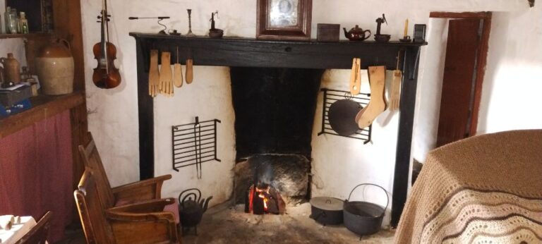
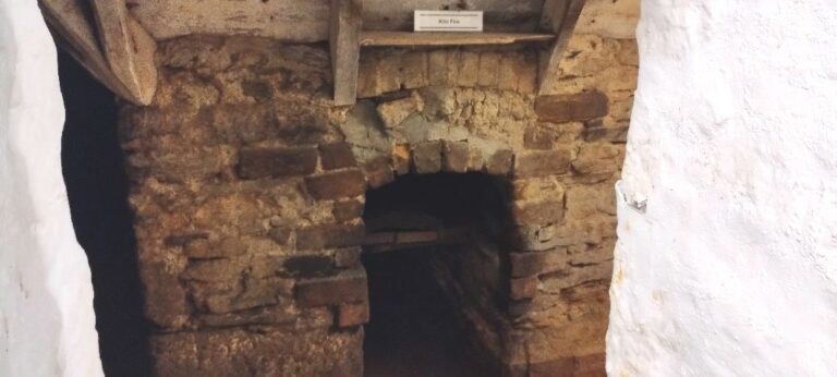
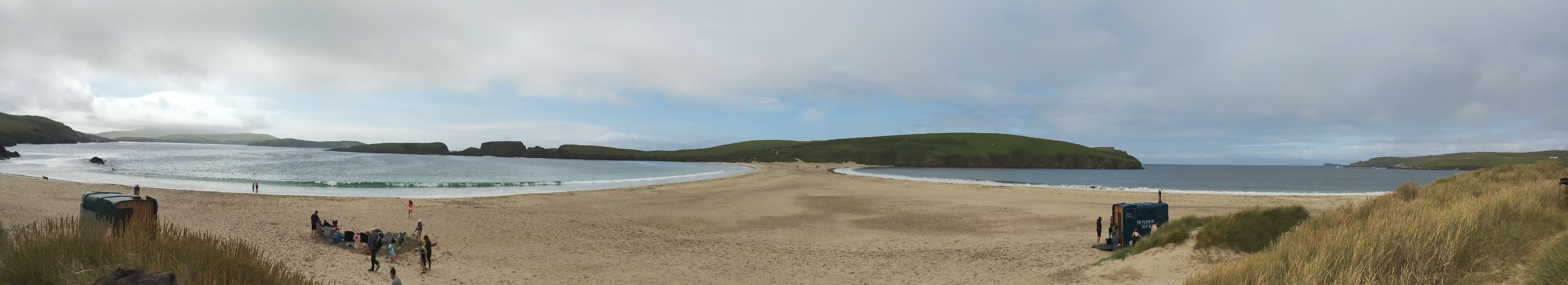
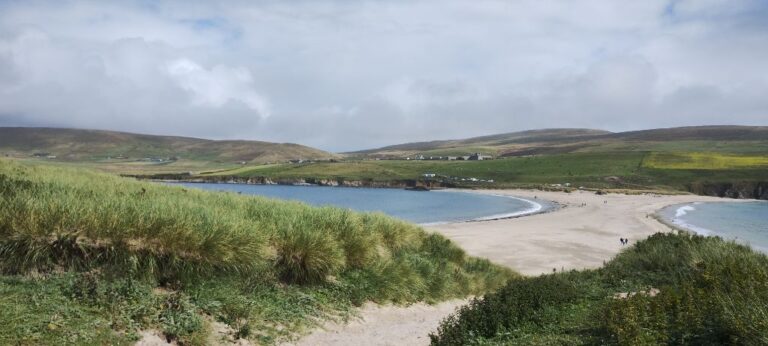
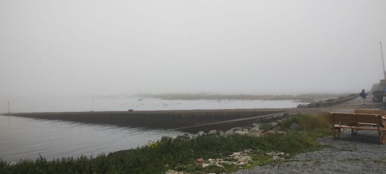
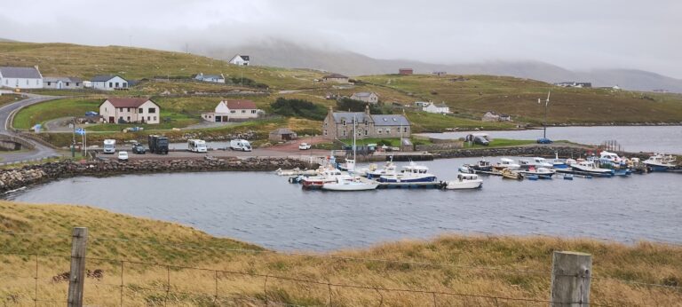
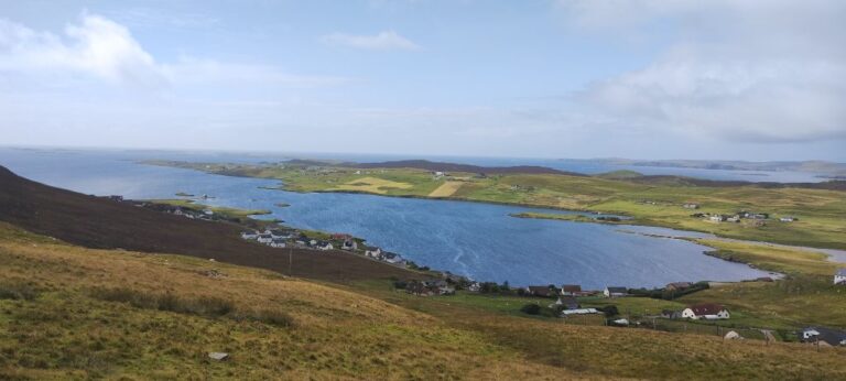
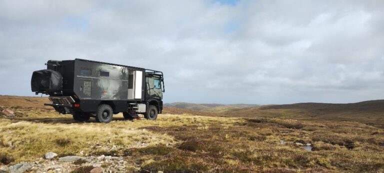
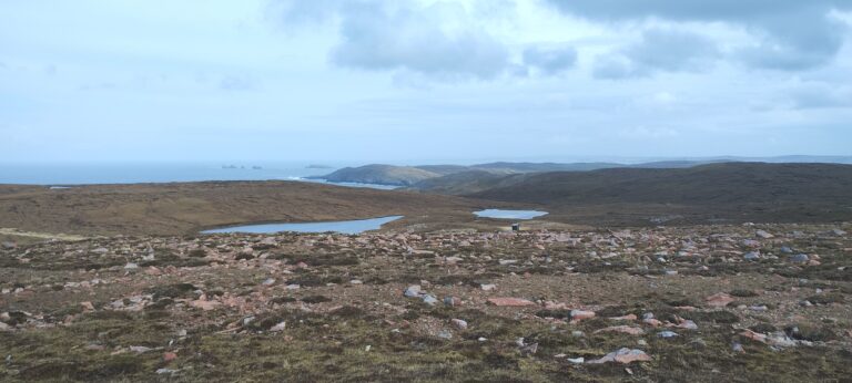
In our meandering travels we stay in a wide variety of places. Wilderness. Grocery store parking lots. Community campgrounds. Road side parking. Whiteness Overlook is located on a small, short stretch of road (less than 1/2 km long) that is a “layby”. In Scotland you can park overnight in laybys. We stayed in the Whiteness Overlook layby on two separate occasions due to its convenient location and spectacular views.

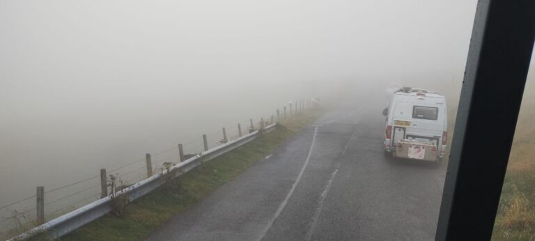
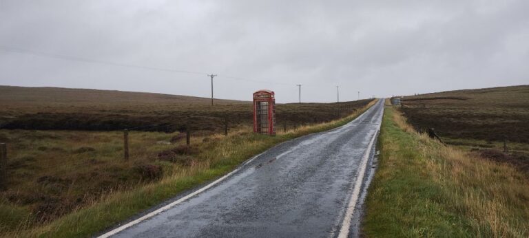
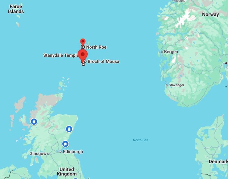
We decided to check out the island of Muckle Roe, population 130. The island is connected to Mainland by a bridge. This bridge is the last two-lane road we encounter on Muckle Roe. In fact, the roads on Muckle Roe are less one lane roads and more 1/2 – 3/4 lane roads. This is a good place to come if you want to see how long you can balance your vehicle with all wheels hanging off the edge of the road. But wait! It gets more fun! Oncoming traffic, yeah! Actually, the locals are great. Everyone keeps an eye out for oncoming vehicles, and will pull over into passing bays well in advance. We never had an occasion where we, or the oncoming vehicle, had to back up to get to a passing bay.

Note: passing bays are areas where the road is slightly wider allowing oncoming vehicles to inch past one another. Passing bays were not designed with Rosie in mind. The width and frequency of passing bays seems to have been decided by Loki (Norse God of Mischief). Some roads have frequent passing bays, others not so much or none. Some passing bays are wide enough to allow two buses to pass. Other passing bays are wide enough for a Honda Civic and a bicycle to pass.

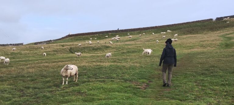
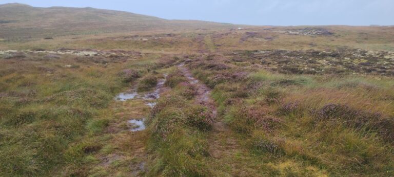
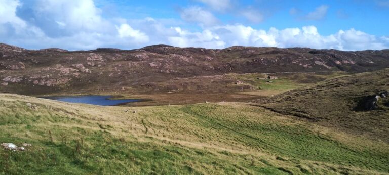
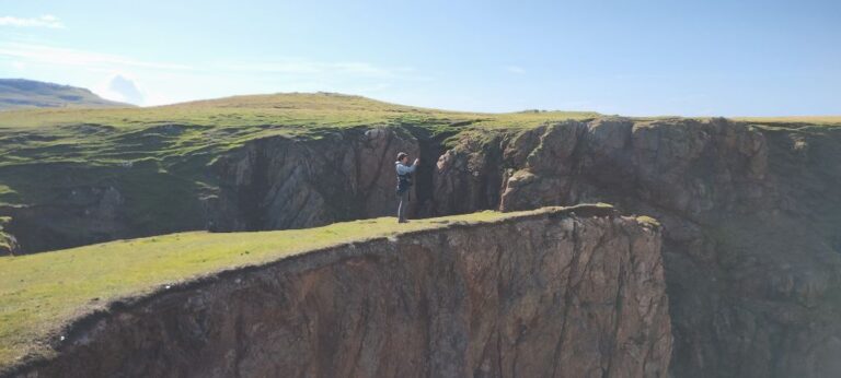
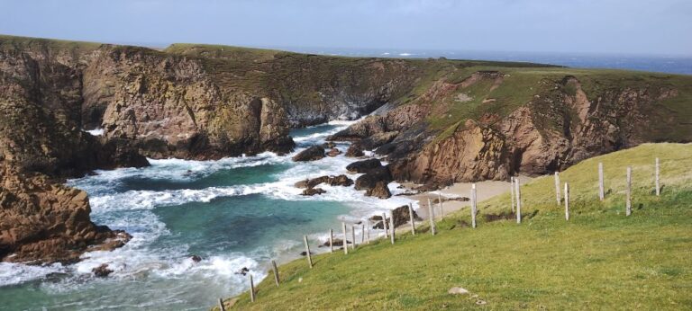
We arrive at Ham Track, our destination on Muckle Roe. This is a walking path that follows a farmer’s track from one side of the island to the other (it’s a small island).

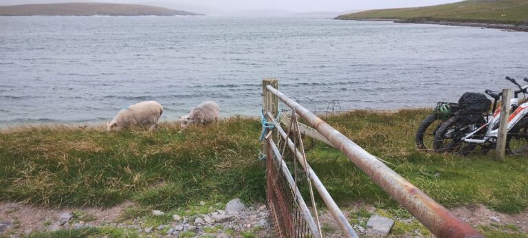
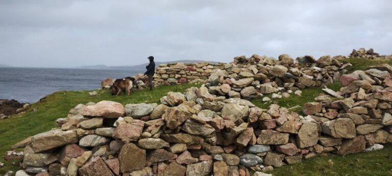
Apparently, something is going on with the sheep at this time of year as there are “no dogs” signs up on the path entrance. So dogs get to have a snooze while we explore. And the exploring bears fruit immediately.  We see a farmer moving sheep, using his dog, into a pen area. He then starts shearing the sheep, so we watch for a while. The farmer tells us that the sheep have been brought down from the commons (land used by several farmers). Each farmer uses a different colour paint on the sheep, so that they can tell each others sheep apart. The sheep are being sent off to market (bad for the sheep, good for us), with some sheep (young ones) being held back for next year. The majority of sheep are sent to market as it is too expensive to feed them over the winter. The wool that is sheared is sent to a local buyer, who aggregates the wool from several farmers and sells it to wool processors.

After our walk we pass the recently sheared sheep and can tell that something is amiss. The young sheep are bleating loudly. The farmer we met earlier is just packing up, so we ask what all the commotion is about. “They don’t recognize their mothers after shearing”. It takes them a while to find their mothers and in the meantime they make a lot of noise and run around.   We learn something new everyday.

Ham Track on Muckle Roe (follows the farmer's track).
Ham Track.

Incredible views as we walk along Ham Track. There is a bit of a story to the building at the end of the track which we discovered after our walk (from the farmer who was shearing his sheep). The property owner wanted to rebuild the stone house, just visible on the right side of the above photo. The local council didn’t want the owner to make any changes to the “heritage” buildings on the property. The owner then asked for permission to build a cottage on the property. No. Not in keeping with the intended use of the land (farming). So the owner then applied, and was given permission, to build a farm shed on the property. Inside the shed he built a full cottage.

Another view from Ham Track.
Ham Track ends at a spectacular coast.
Risking life and limb to get the perfect photo.

We got talking to an individual who used to live in Shetland, but now lives in Aberdeen. This person also has an expedition vehicle, so we got to talking about a whole pile of expedition related subjects, one of which was where to stay in Shetland. This person knew the owner of some land near where we had planned to go next and got permission from the owner for us to stay on his property. He went as far as to take us in his truck to view the property. This was a 30 minute drive (each way) down a farmer’s track in the middle of nowhere. It was perfect for us!

We got Rosie ready for some off-road work, changed drivers (one of us does mostly road driving, the other off-road driving) and worked our way along the track. It was quite rough, but just perfect for Rosie!

Rosie parked on private property in the middle of nowhere, and loving it!
Rosie can just be seen in front of the lake on the right. No neighbours here!
A walk down the farmer's track gets us to some more spectacular coast!
Supposedly, if you follow the path between the fence posts you can get to a beach, but it looks like the path disappears over the steep edge, so we didn't chance it.
Even out here, in the middle of nowhere, we find ruins. They are everywhere!
Map of Mainland, Shetland

Leave a Comment

Your email address will not be published. Required fields are marked *